
 Maptek is excited to share the latest success stories that highlight how Maptek decision support technologies are helping customers to change forever the way mining is done.
In this issue
Identifying potential risk and managing visitor safety in limestone cave formations in eastern Australia was made easier with Maptek laser scanning and software technology. Participation in the Geology Challenge created an opportunity to streamline the resource modelling workflow for an independent consulting company, and the future for working with point cloud data looks bright.
Here is a curated selection of articles in the latest Forge. Alternatively click to view Forge March 2023.
|
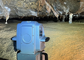
Laser scanner and UAV geotechnical data is instrumental in identifying potential risk and managing visitor safety in limestone cave formations in Victoria, eastern Australia. (Case study courtesy AECOM and Parks Victoria). |
|
Maptek Development Strategy Manager Andy Newman discusses technologies in the geomatics space that will save time in managing files, create value from point cloud data, and help ease the global skills shortage. |
|
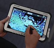
PointModeller - the right tools for the job Maptek PointModeller offers powerful 3D visualisation, smart registration and filtering to derive value from airborne or mobile sensor data for quarry, civil or topographic projects. |
|
Improved depth perception in visualising software imagery has transitioned from a Maptek experiment into incorporation within current point cloud modelling applications.
|
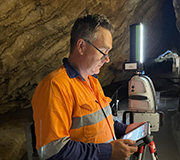 Managing visitor safety at the Buchan Caves
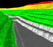 What the future holds for geospatial survey
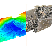
 New depth of field lighting feature for point cloud applications
-
Subscribe to Forge – it’s free and delivered to your inbox every quarter.
- VISIT MAPTEK WEBSITE
Maptek is a proud supporter of AIMS.